Recent highlight
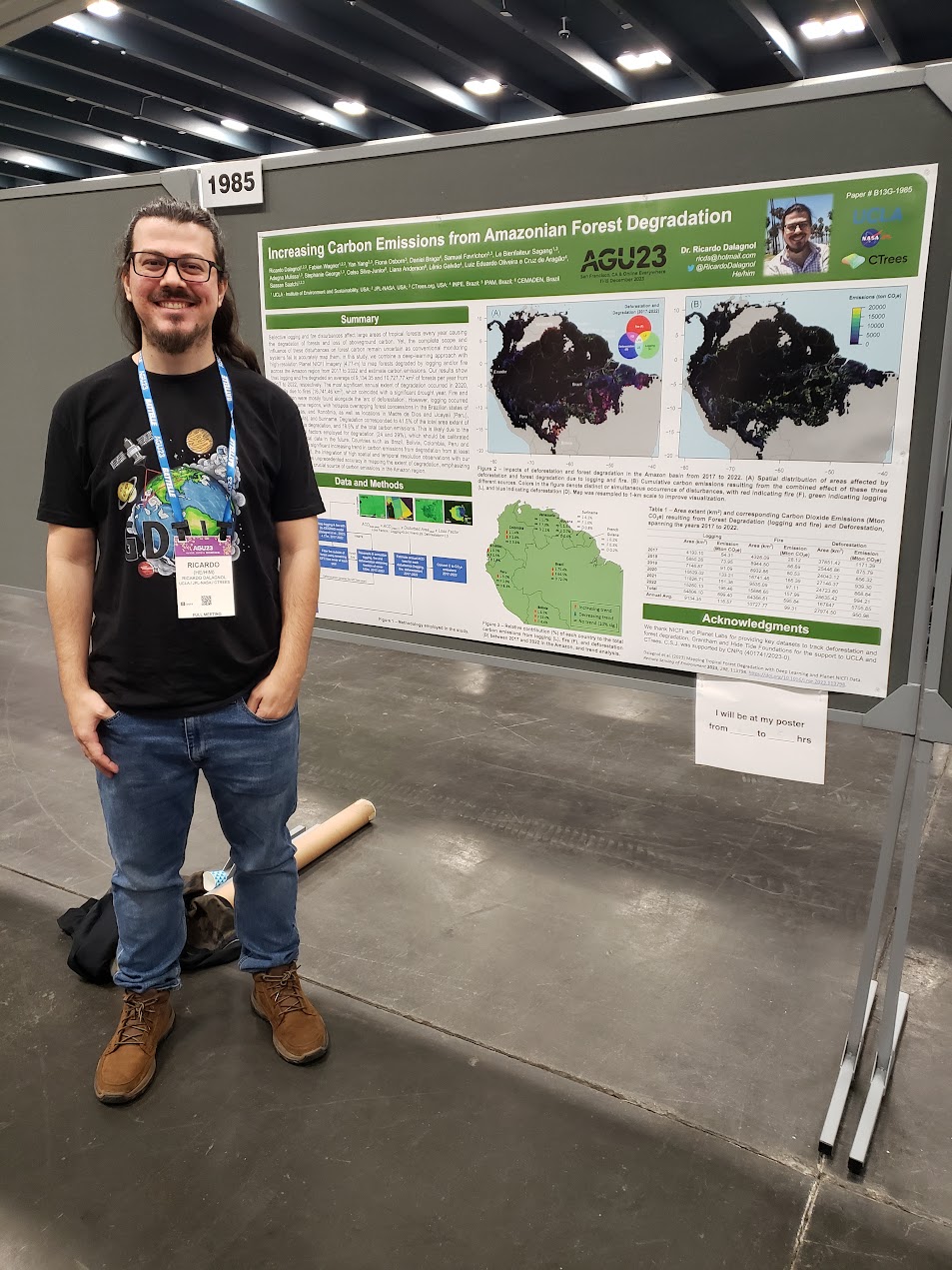
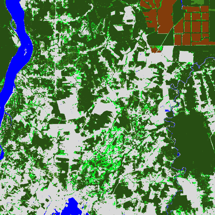
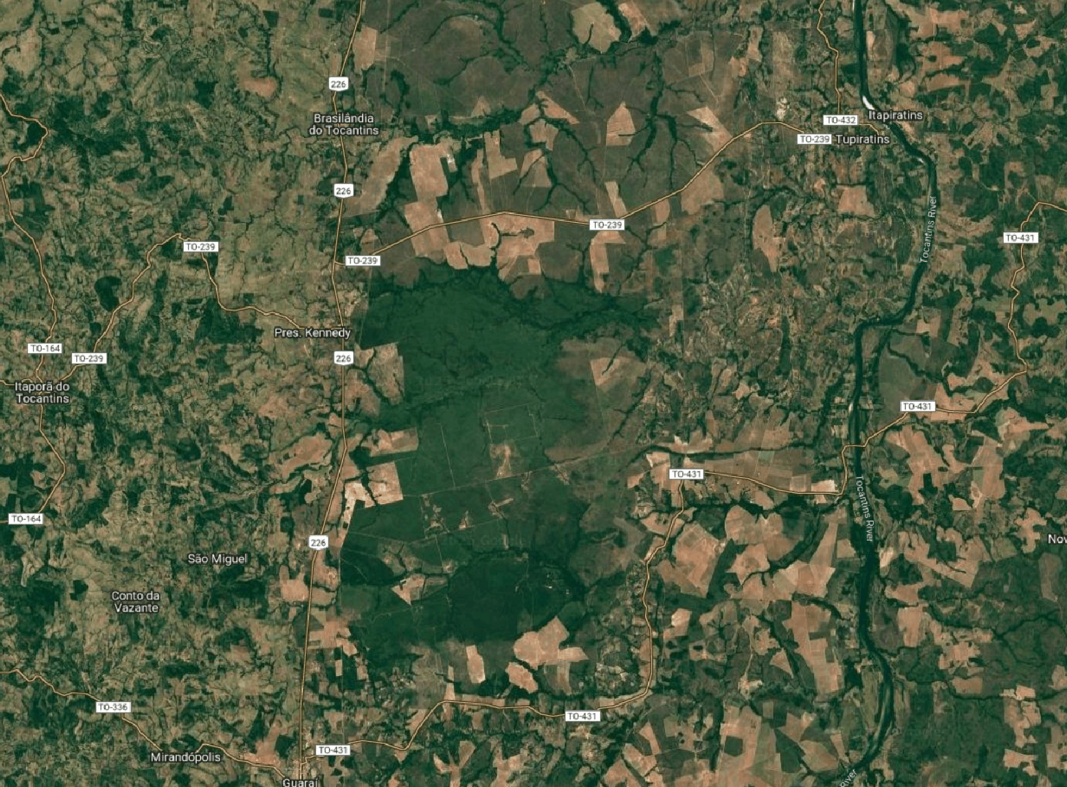
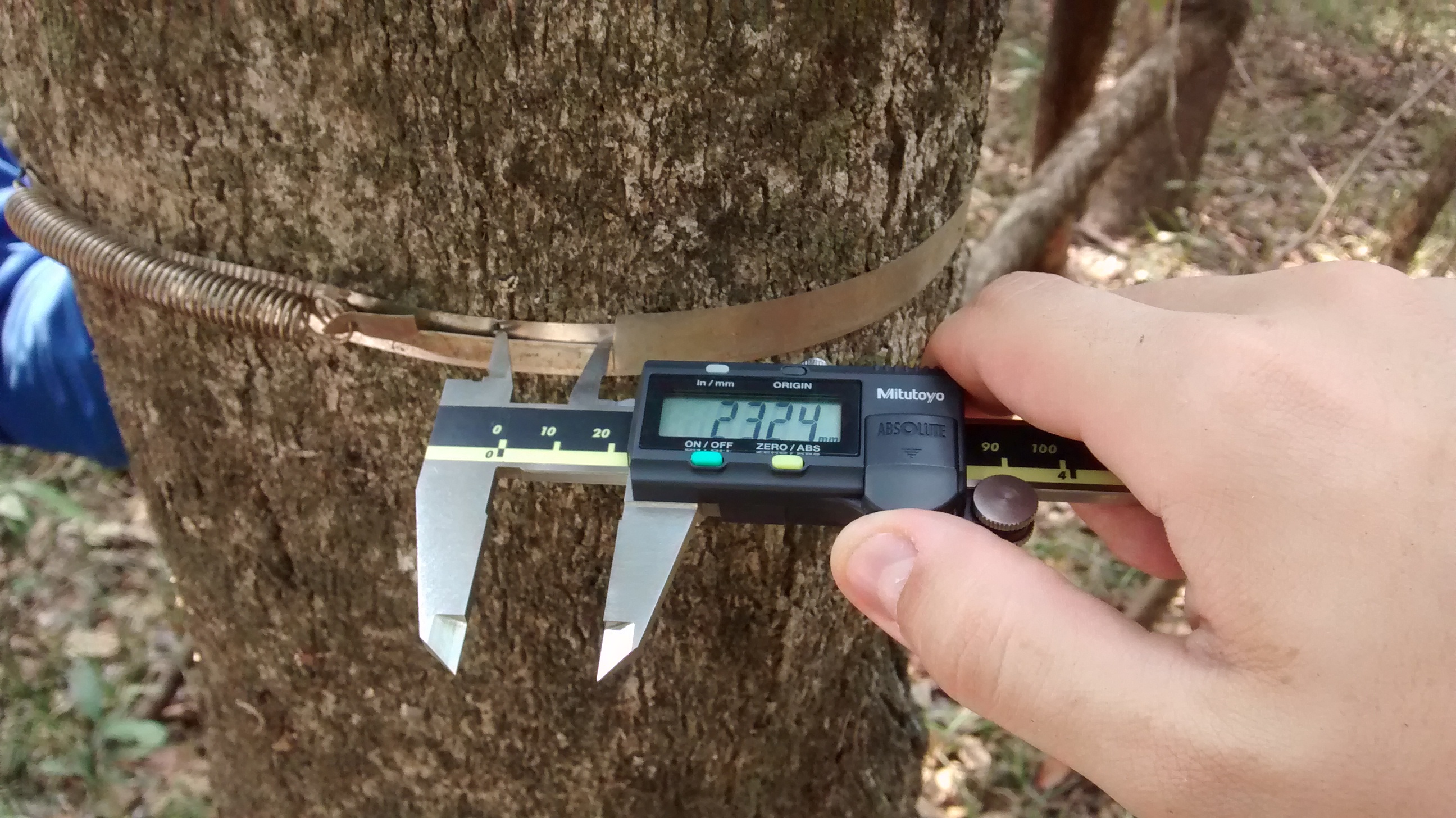
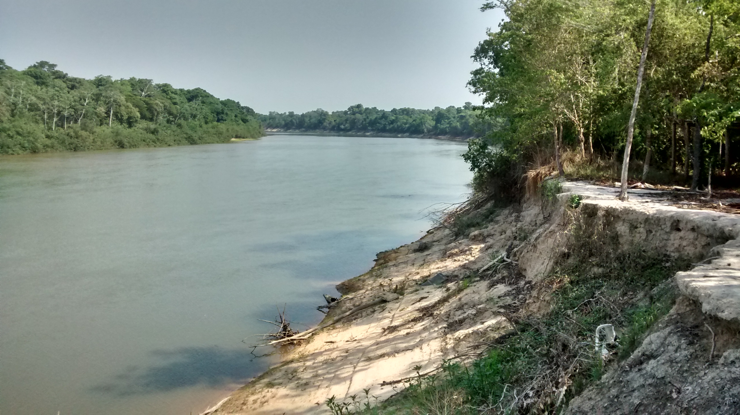
Mapping tropical forest degradation with deep learning and Planet NICFI data
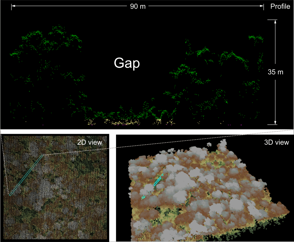
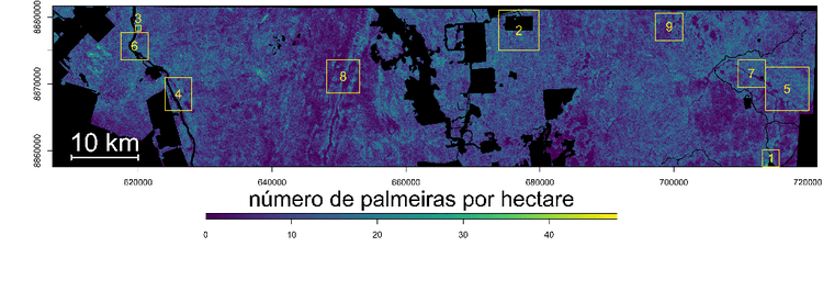
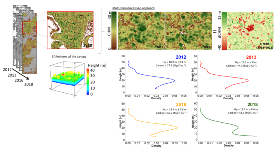
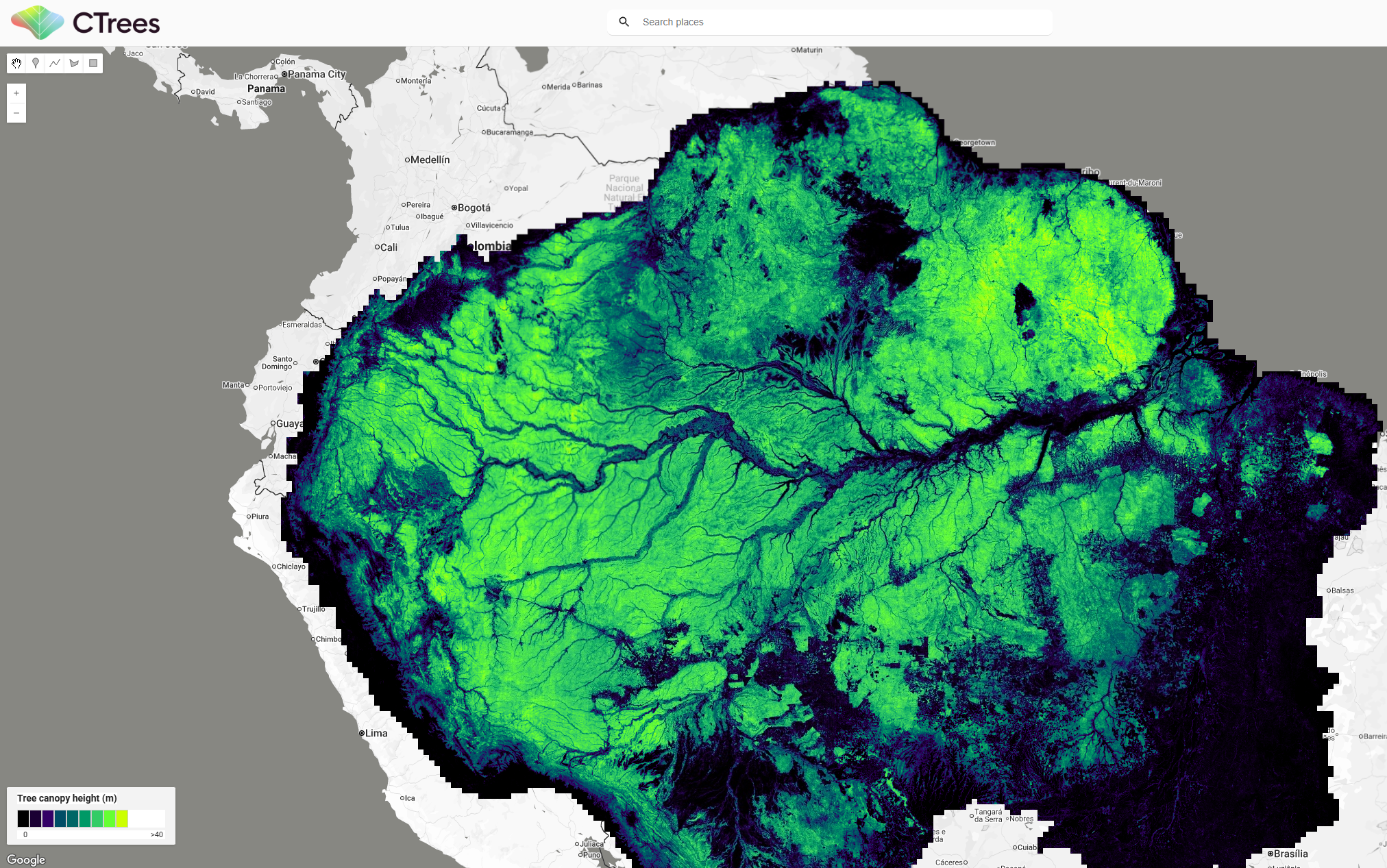
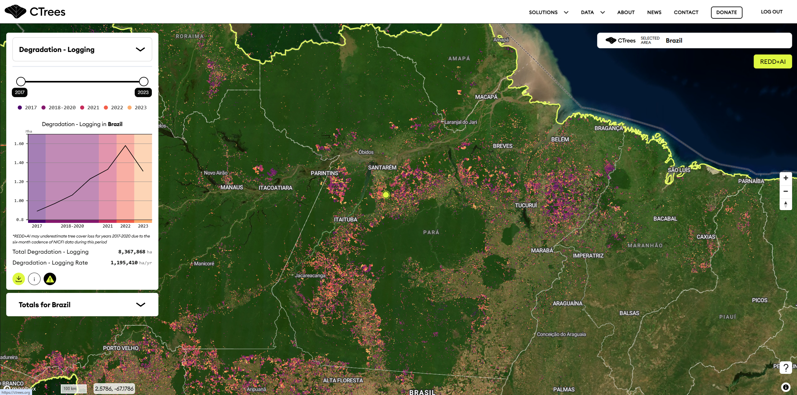
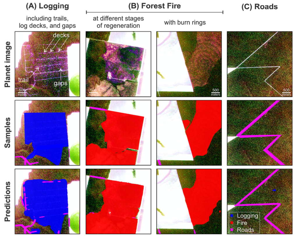
First wall-to-wall, high-resolution mapping of tropical forest degradation using NICFI imagery and deep learning, turning subtle canopy damage into measurable, actionable signals.
Read the paper